Charleston spans hurricane evacuation Zones B and C. West Ashley leaves by S.C. 61, downtown by I-26. Charleston County Emergency Management: 843-746-3800.
Last checked Oct. 12, 2026. Facts on this page come from Charleston County Emergency Management, the state’s hurricane guide at hurricane.sc and the City of Charleston’s WaterWise page. Hurricane season runs June 1 to Nov. 30.
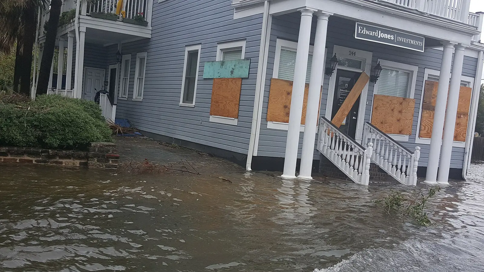
Charleston gets two kinds of storm trouble: hurricanes that can bring an evacuation order, and the flooding that comes with heavy rain on top of a high tide. Both arrived last weekend. Rain from Hurricane Isaias, which tracked west of the city, and king tides closed 21 city roads by Saturday morning, Oct. 10, the city said. Know your zone, your route and your flood plan before the next one.
Who to call
- Charleston County Emergency Management: 843-746-3800
- City storm information, flooding, non-emergency questions: Citizen Services Desk, 843-724-7311, citizenservices@charleston-sc.gov
- Emergency alerts: CHS Alerts, the county’s alert system
- Forecasts and warnings: the National Weather Service in Charleston
- Evacuation traffic: dial 511 or 511sc.org
- Life-threatening emergency: 911
Know your zone
Charleston County’s evacuation zone map (PDF) has three zones, drawn from National Hurricane Center storm surge data:
| Zone | Areas, in the county’s words |
|---|---|
| A | Edisto Island; the immediate coast including Seabrook, Kiawah, Folly Beach, Sullivan’s Island, Isle of Palms and Dewees; east of U.S. 17 to Buck Hall |
| B | Mount Pleasant, James Island and Johns Island; north of Mount Pleasant between Zone A and U.S. 17; the southern Charleston peninsula to Shipyard Creek |
| C | North of Zone B along the I-26 corridor to the county line; between U.S. 17 and the county line; West Ashley and the areas behind the islands |
An order may cover one zone, two or all three. Look up your address on the state’s Know Your Zone map. Daniel Island and Cainhoy are in Berkeley County, which runs its own zones; the same state map covers them.
Your evacuation route
The state’s evacuation plan for the city:
- West Ashley: S.C. 61 to U.S. 78, U.S. 321 and S.C. 389 to I-20.
- Downtown: the normal lanes of I-26.
- James Island: S.C. 171 to U.S. 17, then U.S. 17 south to I-526 and the normal lanes of I-26.
- Johns Island: S.C. 700 to Main Road to U.S. 17, then U.S. 17 south to S.C. 64 toward Walterboro, Aiken and I-20.
- Daniel Island: I-526 or Clements Ferry Road as conditions allow.
Under some conditions, lanes of I-26 are reversed to carry traffic inland; access to the reversed lanes begins at the Nexton crossover near Exit 197. Follow law enforcement, signs and 511. The county advises being ready to drive 20 to 50 miles inland and keeping your gas tank full once a hurricane watch is issued.
Flooding and storm parking
When the city expects flooding, it activates its flood plan: crews clear storm drains, mobile pumps go in, Colonial Lake and Lake Dotterer are lowered and barricades are staged.
- Free storm parking. The city opens five garages free to city residents so they can move cars off flood-prone streets: Aquarium Garage, 24 Calhoun St.; Visitors Center Garage, 63 Mary St.; Queen Street Garage, 93 Queen St.; East Bay/Prioleau Garage, 25 Prioleau St.; and Charleston Tech Center Garage, 4 Conroy St. Pull a ticket, then scan the city’s storm parking QR code at the exit. The city announces start and end times each time; cars left after that may be charged.
- Street closures in real time: the TIDEeye tool on WaterWise.
- Do not drive through water. City law makes it unlawful to drive faster than 5 mph, or to push a damaging wake, on a street with 6 or more inches of water. Police can ticket drivers who go around barricades.
Watches and warnings
- Hurricane watch: hurricane conditions are possible within 48 hours. Check your kit, fill the car, refill prescriptions and bring in outdoor furniture.
- Hurricane warning: a hurricane is expected within 36 hours. Finish preparing, and leave as soon as possible if an evacuation is ordered.
Shelters
Shelters open only when a storm threatens. Charleston County lists them on its emergency shelters page. Bring blankets, bedding and your own supplies. Plan for pets ahead of time.
Your kit
The city’s hurricane checklists cover a preseason list, an emergency kit, a family communication plan and an evacuation plan; print them in case the power goes out. The county’s watch list: a flashlight, a battery radio and batteries, a first aid kit and medicines, food that keeps, water and a manual can opener, cash, and sturdy shoes.
Flood insurance
A standard homeowners policy does not cover flooding, and a new National Flood Insurance Program policy normally has a 30-day waiting period, the county says. Buy it before a storm is in the forecast. Flood zone questions go to the Building Inspections station at the city’s Permit Center; see our permits guide.
Sales tax holiday
South Carolina’s 2026 sales tax holiday was the back-to-school holiday, Aug. 7-9. No separate holiday for hurricane supplies was announced for 2026.
What this means for you
- Find your zone today: much of the peninsula and all of James and Johns islands are Zone B.
- Sign up for CHS Alerts, and know which garage you will use for storm parking.
- Buy flood insurance a month before you need it.
Related guides: power outages, road construction and closures and who to call at City Hall.
Frequently asked questions
What hurricane evacuation zone is Charleston in?
It depends on the neighborhood. Charleston County puts James Island, Johns Island and the southern peninsula to Shipyard Creek in Zone B, and West Ashley and the rest of the peninsula in Zone C. Check your address on the state’s Know Your Zone map at hurricane.sc.
What is the hurricane evacuation route from Charleston?
The state’s plan sends West Ashley out on S.C. 61 to U.S. 78, and downtown on the normal lanes of I-26. James Island takes S.C. 171 to U.S. 17, then I-526 to I-26. Daniel Island uses I-526 or Clements Ferry Road.
Where can I park my car during a flood in Charleston?
When flooding is expected, the city opens free storm parking for residents in five garages: Aquarium, Visitors Center, Queen Street, East Bay/Prioleau and Charleston Tech Center. The city announces the opening and closing times each time.
Where are hurricane shelters in Charleston County?
Shelters open only when a storm threatens. Charleston County Emergency Management lists open shelters on its shelters page.
When does hurricane season end?
The Atlantic hurricane season runs June 1 to Nov. 30.
Have your say