The City of Charleston's part of Johns Island is ZIP code 29455 and zoned for St. John's High. Typical home value: $746,511 in September 2026.
Last checked Oct. 16, 2026. Sources: the City of Charleston’s Charleston City Plan and GIS map service, Charleston County School District’s school lookup tool, the South Carolina school report cards, CARTA, OpenStreetMap and Zillow Research.
Johns Island is the large island south and west of West Ashley and James Island, across the Stono River. The City of Charleston covers part of it. The city’s City Plan counts 16 square miles in its Johns Island planning area and estimated 10,961 people there in 2019, up 108% from 2010, the fastest growth of any part of the city. It says growth trends point to about 2,000 more homes over 10 years, “developed at the lowest density of all city areas.”
What this means for you
- Zoned high school: St. John’s High, rated Average on the 2025 state report card, for almost every point we checked. Check an address with the district’s school lookup tool.
- Home value: $746,511 in ZIP code 29455 in September 2026, according to the Zillow Home Value Index.
- Nearest interstate exit: none on the island. I-26 Exit 221 is about 12 miles by road from Johns Island Park, and I-526 Exit 11 about 13.2 miles.
Part of our Charleston neighborhoods guide.
Where it is
Maybank Highway (S.C. 700) and River Road are the main roads, with Bohicket Road to the south. The City Plan says most development on the island will happen inside the Urban Growth Boundary, an area “bounded approximately by Brownswood Road, Cane Slash Road, River Road and Bohicket Road,” concentrated at “three nodes of Maybank.” Inside that boundary, it says, existing development is 52% residential and 20% agricultural, and the industrial land is mostly the Charleston Executive Airport. Much of the island outside it is unincorporated Charleston County; check a parcel on Charleston County’s GIS Parcel Viewer.
Of the 1,487 points we checked inside the city limits, 99% were in ZIP code 29455, all in Charleston County. The city’s neighborhood council map lists five associations here: Headquarters Island, Rushland Plantation, Dunmovin/Island Estates, Winnsboro Lakes and Sea Island Place. The city’s Johns Island Restoration Plan looks at flood resiliency on the island.
Schools
We checked every point against Charleston County School District’s attendance boundaries in its school lookup tool (elementary zones for 2026-27, middle and high school zones for 2025-26).
| Level | School | Share of points | 2025 state rating |
|---|---|---|---|
| Primary (4K-1) | Angel Oak, 6134 Chisolm Road | 99% | Good |
| Elementary (2-5) | Johns Island Elementary, 2950 Claybrook St. | 99% | No 2025 rating |
| Middle | Haut Gap Middle, 1861 Bohicket Road | 99% | Good |
| High | St. John’s High, 1518 Main Road | 99% | Average |
The district’s map splits the elementary years between Angel Oak, for 4-year-old kindergarten through first grade, and Johns Island Elementary, for second through fifth grade. Angel Oak’s 2025 rating was for its earlier pre-K to fifth grade school; Johns Island Elementary has no 2025 report card. St. John’s High’s 2025 graduation rate was 92.5%. Ratings are the overall ratings on the state’s 2025 report cards. More in our schools guide.
Home values
The Zillow Home Value Index for ZIP code 29455 was $746,511 in September 2026, up 2.5% from $728,508 in September 2025. Zillow’s figure for the City of Charleston as a whole was $587,511. The index is a modeled typical value for the middle third of homes, not a sale price, and 29455 also covers unincorporated land. More in our home prices guide.
Parks and trails
From the city’s parks layer on its GIS map service:
- Johns Island Park, 1761 Hay Road: about 27 acres with baseball, tennis, a playground, a dog park and picnic areas.
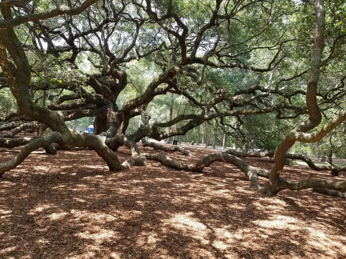
- Angel Oak Park, 3688 Angel Oak Road: the city-owned Angel Oak, with a playground and picnic area. Hours are in our parks and trails guide.
The layer also marks city land for a future park on Griffith Lane and a future Johns Island recreation center property at 140 Kathryn Ross Way.
Getting around
- Interstate: none on the island. I-26 Exit 221, Meeting Street, is about 12 miles by road from Johns Island Park, and I-526 Exit 11, Paul Cantrell Boulevard and Glenn McConnell Parkway, about 13.2 miles. Exit numbers are as mapped on OpenStreetMap.
- City Hall, 80 Broad St.: about 12.7 miles.
- Charleston International Airport: about 19.3 miles.
- Bus: CARTA’s schedule data shows no regular route stopping in the city’s part of the island. See CARTA’s maps and schedules.
Distances are measured on the OpenStreetMap road network from Johns Island Park; they are distances, not drive times. More in our getting around guide.
Groceries and everyday stores
From OpenStreetMap:
- Supermarkets: Food Lion, 2770 Maybank Highway, and Lowes Foods, 3575 Maybank Highway.
- Pharmacy: CVS, 2803 Maybank Highway.
Homeowners and neighborhood associations
Three of the five associations on the city’s neighborhood council map here are homeowners or property owners associations by name: Headquarters Island, Winnsboro Lakes and Sea Island Place. Rushland Plantation and Dunmovin/Island Estates are neighborhood associations. The city’s Neighborhood Services office works with them.
Frequently asked questions
What high school is Johns Island zoned for?
St. John’s High School, 1518 Main Road. Almost every point we checked in the City of Charleston’s part of Johns Island was zoned for it in Charleston County School District’s attendance boundaries. It was rated Average on its 2025 state report card, with a 92.5% graduation rate.
Is Johns Island part of the City of Charleston?
Partly. The city’s Johns Island planning area covers about 16 square miles, mostly along Maybank Highway and River Road; much of the rest of the island is unincorporated Charleston County. Charleston County’s GIS Parcel Viewer shows which a parcel is in.
What is the typical home value on Johns Island?
The Zillow Home Value Index for ZIP code 29455 was $746,511 in September 2026, up 2.5% from a year earlier. The ZIP code also covers unincorporated land.
How fast is Johns Island growing?
The city’s City Plan estimated 10,961 people in its Johns Island planning area in 2019, up 108% from 2010, the largest percentage increase of any part of the city.
Have your say