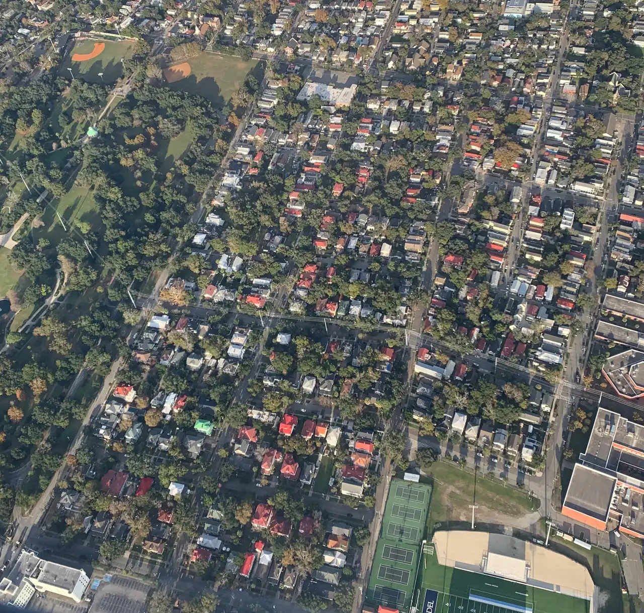
Charleston's upper peninsula, from Hampton Park and Wagener Terrace to the Neck, is mostly ZIP code 29403 and zoned for Burke High School.
Last checked Oct. 16, 2026. Sources: the City of Charleston’s Charleston City Plan, its Upper Peninsula Zoning District overview (PDF) and GIS map service, Charleston County School District’s school lookup tool, the South Carolina school report cards, CARTA, OpenStreetMap and Zillow Research.
The upper peninsula is the part of the Charleston peninsula north of the Crosstown (U.S. 17, the Septima P. Clark Parkway), from Hampton Park and The Citadel up through the Neck to the North Charleston city line. The city’s City Plan uses “Upper Peninsula” for this end of the 8-square-mile peninsula and names the high ground of the planned Magnolia development on the Neck as suitable for higher density. It mixes older neighborhoods of houses with industrial land along the rivers.
What this means for you
- Zoned high school: Burke High, rated Below Average on the 2025 state report card, for about 95% of the points we checked. Check an address with the district’s school lookup tool.
- Home value: $855,456 in ZIP code 29403 in September 2026, according to the Zillow Home Value Index.
- Nearest interstate exit: I-26 runs up the middle of the area; Exit 221, Meeting Street, is about 2.1 miles by road from Hampton Park.
Part of our Charleston neighborhoods guide.
Where it is
The area runs north from the Crosstown between the Ashley River on the west and the Cooper River on the east. King Street, Rutledge Avenue, Meeting Street and Morrison Drive are the main north-south roads, and I-26 runs through the middle. Of the 775 points we checked inside the city limits, about two thirds were in ZIP code 29403; most of the rest, at the northern end on the Neck, were in 29405. Nearly all of it is in Charleston County.
The city’s neighborhood council map names more than a dozen associations here. The largest by area are Silver Hill/Magnolia, Four Mile Hibernian, Wagener Terrace, Rosemont, the Westside, North Central, East Central and Hampton Park Terrace. The City Plan lists Hampton Park Terrace as an example of its “Neighborhood” land use, with regular blocks and six to 12 homes an acre, and Wagener Terrace as an example of “Suburban,” with four to eight.
East of I-26, between Huger Street and Milford Street, the city’s Upper Peninsula Zoning District loosens height and density limits in exchange for amenities such as affordable housing, green space and transportation. The city says it was drawn to leave out every single-family zoned property, according to its overview (PDF). The 2014 study behind it counted 3,138 people and 1,314 homes in an 865-acre study area. See our permits and zoning guide.
Schools
We checked every point against Charleston County School District’s attendance boundaries in its school lookup tool (elementary zones for 2026-27, middle and high school zones for 2025-26).
| Level | School | Share of points | 2025 state rating |
|---|---|---|---|
| Elementary | Sanders-Clyde Elementary, 805 Morrison Drive | 67% | Good |
| Elementary | James Simons Montessori (K-5) or Sanders-Clyde | 24% | Average (James Simons) |
| Middle | Simmons-Pinckney Middle, 244 President St. | 95% | Unsatisfactory |
| High | Burke High, 244 President St. | 95% | Below Average |
Where the map lists two elementary schools, the district offers either one. A few points near the Crosstown were zoned for Memminger Elementary, and about 3% at the northern end of the Neck for Mary Ford and Chicora elementary schools, Morningside Middle and North Charleston High. Burke’s 2025 graduation rate was 78.6%. Ratings are the overall ratings on the state’s 2025 report cards. Charleston Charter School for Math and Science, 1002 King St., takes students by application; see our schools guide.
Home values
The Zillow Home Value Index for ZIP code 29403 was $855,456 in September 2026, up 5.3% from $812,504 in September 2025. ZIP code 29405, which covers the Neck and much of southern North Charleston, was $309,648, down 2.4%. Zillow’s figure for the City of Charleston was $587,511. The index is a modeled typical value for the middle third of homes, not a sale price. More in our home prices guide.
Parks and trails
From the city’s parks layer on its GIS map service:
- Hampton Park, 30 Mary Murray Drive: about 51 acres with picnic areas and a dog park.
- Brittlebank Park, 181 Lockwood Drive: 11 acres on the Ashley River with a playground and fishing.
- Harmon Field Park, 201 President St.: ball fields, soccer and a playground.
- Martin Park, 155 Jackson St.: baseball, basketball, tennis and a playground.
- McMahon Playground, 55 Cleveland St., in Wagener Terrace.
- Coach Stanley Chisolm Park, 2055 Austin Ave., in Rosemont, and Rosemont Field, 1960 Austin Ave.
- Jack Adams Tennis Center, 285 Congress St.
Details in our parks and trails guide.
Getting around
- Interstate: I-26 exits at Rutledge Avenue (219A), Morrison Drive and East Bay Street (219B) and Meeting Street (221) are inside the area. Exit 221 is about 2.1 miles by road from Hampton Park. Exit numbers are as mapped on OpenStreetMap.
- City Hall, 80 Broad St.: about 3.2 miles from Hampton Park.
- Charleston International Airport: about 10.9 miles.
- Bus: CARTA Route 102, North Neck, runs along Ashley and Austin avenues; Route 20 runs up King Street; routes 10 and 11 run up Meeting Street; and the free DASH Route 213 stops at Brittlebank Park, according to CARTA’s schedule data.
Distances are measured on the OpenStreetMap road network; they are distances, not drive times. More in our getting around guide.
Groceries and everyday stores
From OpenStreetMap:
- Supermarkets: Publix, 10 WestEdge St., and Food Lion, 1015 King St.
- Pharmacies: OpenStreetMap lists none inside the area; the nearest are downtown, including Walgreens, 200 Rutledge Ave.
Neighborhood associations
The City of Charleston’s neighborhood council map, on its GIS map service, lists associations for Wagener Terrace, Hampton Park Terrace, the Westside, North Central, East Central, Rosemont, Silver Hill/Magnolia, Four Mile Hibernian and Bridgeview, and residents’ associations for public housing communities including Gadsden Green and Meeting Street Manor. The city’s Neighborhood Services office works with them. These are neighborhood associations, not mandatory homeowners associations.
Frequently asked questions
What high school is Wagener Terrace zoned for?
Burke High School. About 95% of the points we checked on the upper peninsula, including Wagener Terrace and Hampton Park Terrace, were zoned for Burke in Charleston County School District’s attendance boundaries. Burke was rated Below Average on its 2025 state report card.
What ZIP code is Hampton Park in?
Hampton Park and the neighborhoods around it, Hampton Park Terrace, Wagener Terrace and North Central, are in ZIP code 29403. The northern end of the peninsula, toward North Charleston, is in 29405.
What is the typical home value on Charleston’s upper peninsula?
Zillow does not publish a figure for the upper peninsula alone. The Zillow Home Value Index for ZIP code 29403 was $855,456 in September 2026, up 5.3% from a year earlier; that ZIP code also covers part of downtown.
What is the Upper Peninsula Zoning District?
It is an incentive-based city zoning district east of I-26 between Huger Street and Milford Street that allows more height and density in exchange for amenities such as affordable housing and green space. The city says no single-family zoned properties were included.
Have your say